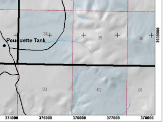
 One of the handiest techniques of making maps is placing a measured grid, in either lat/long or UTMs, on your map. Anyone with a GPS can figure out where they are on the map. Style preferences I follow include: Changing the 'Clip to Shape' as the current visible extent (while in layout mode), Change the label offset to 1 or 0, Change the size of the tic marks to 0 or 1, and place tic mark instead of lines inside the map.
Friday, July 22, 2011
Grid: Data Frame Properties
 One of the handiest techniques of making maps is placing a measured grid, in either lat/long or UTMs, on your map. Anyone with a GPS can figure out where they are on the map. Style preferences I follow include: Changing the 'Clip to Shape' as the current visible extent (while in layout mode), Change the label offset to 1 or 0, Change the size of the tic marks to 0 or 1, and place tic mark instead of lines inside the map.
Subscribe to:
Post Comments (Atom)
No comments:
Post a Comment