Any GIS Specialist worth his/her weight in salt must accommodate non-technical users of GIS information. For this reason, I'm pushing for more and more use of Microsoft Excel--where the spreadsheet holds the attribute information and I later join the spreadsheet to a Shapefile.
As a quick tutorial, here is my Excel<->Shapefile methodology.
Right now, I have two spreadsheets.
One spreadsheet holds all the attribute information for my records.
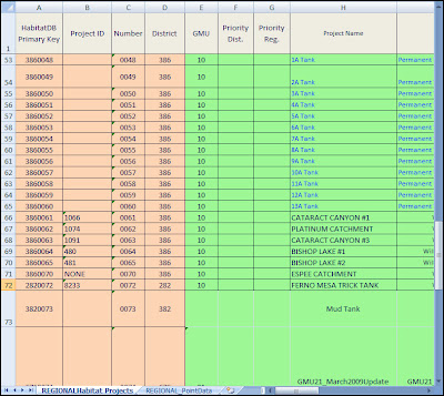
SpreadSheet1And, in the same spreadsheet workbook I keep all of my point data.
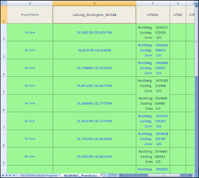
SpreadSheet2
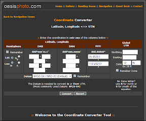
*Side note* I was given Lat/Long Decimal Degrees I used
Oasis Photo to convert them to UTM's; I was having a hard time converting them in the GIS--but once again, a good tool for non-technical users!
In my workbook, I've named my two spreadsheets. This will make it easier for me to identify them when exporting them to a Geodatabase.

Double Click On the SpreadSheet to Change its Name.
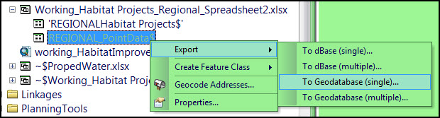
Open the Spreadsheet in ArcCatalog, and Export it:::#:::#::: After A couple Hour Melt-Down, I'm Back! :::#:::#:::
What I think just happened was...
1) I saved the excel as a 2007 format
2) Tried to Export it to ArcGIS Geodatabase--it failed.
3) Then I tried to open it in Excel--that failed.
4) I panic-ed, because it wouldn't open in Excel--ArcCatalog still had a lock on it.
5) Cleaned up all the headers--so there's no special characters, spaces, or so its not too long. Characters like: (,),(`),(!),(.),([]), Leading space, Non-printable characters. (Use Find/Replace to work your data over)
6) Resaved as an Excel 2003-2007 workbook--that worked.
7) Made points out of the xy data--some of them looked wrong!
8) Sweat and Sweat because I couldn't figure out what the projection problem was--there wasn't one (or at least nothing I did).
9) Figured out that the xy coordinates in the attribute table were wrong--but the points were still good (Always, double check your Attribute Geometry!)
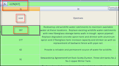
Also, Use the function len(#cellNumber#) to find out how long the cell is, keep it under 255 ;)
Anyways...
The main goal for this database schema is to separate the 'Spatial/Spatially Derived-Data' from the other 'Nominal/Ordinal Data'.
So, the only data that I have in my feature layer is the basics:
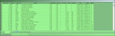
In the feature-layer-attributes, only keep the bare-minimum of attributes. Keep 'Id' and 'Name' and other spatial information like 'xy coordinates' or spatially joined/derived data like 'Township/Range' and 'ManagementUnit'.

